¶ Description
Computes a GIS join.
¶ Parameters
¶ Standard tab
Parameters:
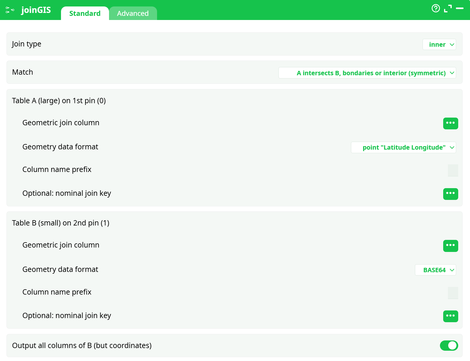
- Join type
- Match
- Table A on 1st pin (large)
- Geometric join column
- Geometry data format
- Column name prefix
- Optional: nominal join key
- Table B on 2nd pin (small)
- Geometric column
- Geometry data format
- Column name prefix
- Optional: nominal join key
- Ouput all columns of B
¶ Advanced tab
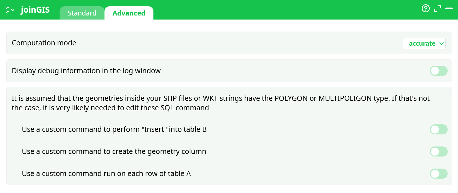
Parameters:
- Computation mode
- Display debug information in the log window
- It is assumed that the geometries inside your SHP files or WKT strings have the POLYGON or MULTIPOLIGON type. If that's not the case, it is very likely needed to edit these SQL command
- Set command to perform "Insert" into table B
- Set command to create the geometry column
- Set command run on each row of table A
¶ About
Computes a join between two table ("Table A" and "Table B") using geographical informations.
As usual, the "Table B" is the "Slave" table: It's completely loaded into memory at the start of the execution, so it should be "small enough" to fit into your RAM memory. To use less RAM, you can load into memory a sub-selection of the columns from "Table B" using the parameter P12.
The different options for the parameters P5 and P9 are:
-
Point Coordinates Latitude Longitude
This format is self-explanatory. The Latitude and Longitude must be stored in the same column, separated with a space char, in decimal degree. -
Rectangle Latitude1 Longitude1 Latitude2 Longitude2
This format is self-explanatory. The 4 numbers must be stored in the same column, separated with a space char, in decimal degree. -
Geometry data in HEX format
This format is for compatibility with PostGreGIS. -
Geometry data in BASE64 format
This is the default geometry format that is given as output of the loadShape action. Basically, you get a "Geometry" column from your .shp Shape files using the loadShape action and you use it here.
The parameter P3 defines the SRID that is used for the computation. Most of the time, you must use the 4326 SRID. When you compute a join between two .shp Shape files, you can freely choose the SRID (but please make sure that both shape files are using the same SRID).
Behind the scene, this ETL action uses the very efficient "Spatial Index" included inside the SpatialiteGIS library to speed-up the computations.