¶ Description
Simplify GIS geometries.
¶ Parameters
¶ Standard tab
Parameters:
- Geometry
- Geometry column
- Geometry data format
- Tolerance
- Preserve Topology
¶ Advanced tab

Parameters:
- Display debug information in the log window
¶ About
SimplifyGIS reduces the complexity of geometries using the Douglas–Peucker algorithm. It is designed for line and polygonal data (LineString/MultiLineString, Polygon/MultiPolygon) but can be called on any geometry type.
When Preserve topology is enabled, the operator avoids oversimplifications that would introduce self-intersections or tear polygons apart (e.g., a circle won’t collapse into a triangle/square).
Tolerance units follow the geometry’s SRID. For SRID 4326, the tolerance is in degrees (≈111 km per degree at the equator). For projected/planar CRSs, the tolerance is in the CRS linear unit (e.g., meters).
¶ Inputs & Outputs
- Input: a table with a geometry column.
- Output: the same table with the geometry simplified in place (the geometry column is overwritten).
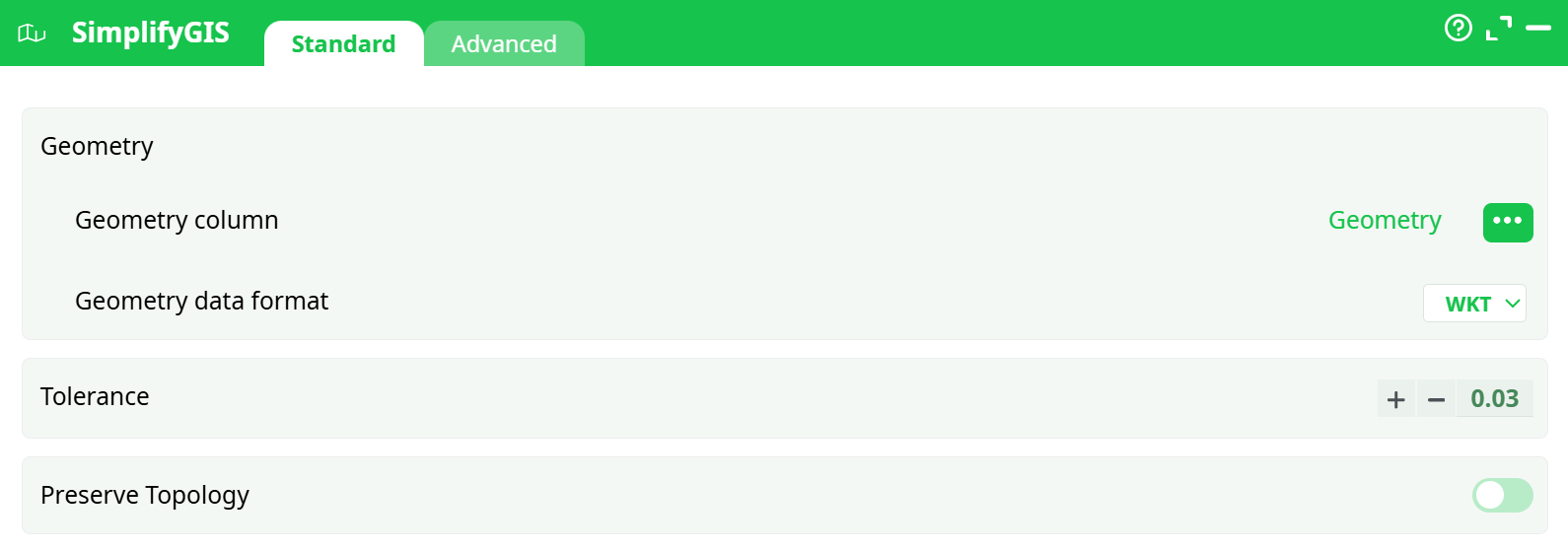
¶ Parameters (Standard)
¶ Geometry
-
Geometry column
Select the column that contains your geometries. -
Geometry data format
Storage/serialization of the geometry field in the table.
Options:- WKT – Well-Known Text (human-readable)
- HEX – Hex-encoded WKB
- BASE64 – Base64-encoded WKB
Choose the format that matches how your geometry column is stored.
¶ Tolerance
Numeric simplification threshold passed to Douglas–Peucker. Larger values remove more vertices (more aggressive simplification).
Rules of thumb
-
4326 (lon/lat):
- 0.0001 ≈ 11 m
- 0.001 ≈ 111 m
- 0.01 ≈ 1.11 km
-
Projected CRS (e.g., EPSG:3857/2154/27700): value is in meters (or CRS unit).
¶ Preserve Topology
When ON, uses a topology-preserving variant that reduces the risk of self-intersections, gaps, and overlaps in polygon shells/holes. Recommended for administrative boundaries and parcel data. Turn OFF only when you need maximal simplification and can accept occasional topological artifacts.
¶ Advanced
- Display debug information in the log window
Prints extra diagnostic information (counts, timing, percent of vertex reduction). Useful for tuning, off by default.
¶ Usage Notes & Best Practices
- Pick a sensible CRS first. If you need a tolerance in meters, reproject your data to a projected CRS (e.g., UTM zone) upstream, simplify there, then reproject back if necessary.
- Iterate on tolerance. Start small, check visual quality, then increase until the map looks right and size/performance goals are met.
- Topology matters. Keep Preserve topology enabled for polygons unless you have a specific reason not to.
- Performance. Runtime scales with number of vertices. Consider tiling/partitioning very large layers upstream.
¶ Example Settings
-
Road network (EPSG:3857)
- Geometry:
geom, HEX - Tolerance:
5(meters) - Preserve topology: ON (keeps network integrity)
- Geometry:
-
Country boundaries (EPSG:4326)
- Geometry:
wkt_geom, WKT - Tolerance:
0.01(≈1.1 km) - Preserve topology: ON
- Geometry:
¶ Common Pitfalls
- Unexpectedly large simplification in 4326. Remember tolerance is in degrees;
0.03≈ 3.3 km. Use a projected CRS for meter-based tolerances. - Artifacts with polygons. Disable Preserve topology only if you accept potential overlaps or self-intersections.
- Wrong geometry format. Ensure the Geometry data format matches how your column is stored; otherwise parsing will fail.